
Back in my own bed, it was very difficult for me to calm down. I kept going over the lists in my mind, trying to make sure I had not forgotten anything. Thunderstorms began and a storm raged all night, with lightening and high wind. I didn’t get much sleep.
Too early the alarm went off. At 5:07 that morning, I showered, and then stepped on my scale: 145 pounds. At 5:28 I was dressed. Wearing hiking boots with two pair of socks and camouflage army pants, my pockets and belt were weighed down with: a full water bottle, bag of trail mix, compass, camera, binoculars, a swiss army knife and other (necessary?) stuff. I now weighed 154 pounds. And, there was still one more item, the backpack, bulging with food, clothes, sleeping bag and tent poles. I hoisted it onto my back. Securing the straps, I stepped on the scale again: 185 pounds.
Too early the alarm went off. At 5:07 that morning, I showered, and then stepped on my scale: 145 pounds. At 5:28 I was dressed. Wearing hiking boots with two pair of socks and camouflage army pants, my pockets and belt were weighed down with: a full water bottle, bag of trail mix, compass, camera, binoculars, a swiss army knife and other (necessary?) stuff. I now weighed 154 pounds. And, there was still one more item, the backpack, bulging with food, clothes, sleeping bag and tent poles. I hoisted it onto my back. Securing the straps, I stepped on the scale again: 185 pounds.

Big drops of rain hit the windshield as I made my way back to Marty’s apartment. There I had a cup of hot cocoa and watched TV as others made final re-arrangements of their gear. We were preparing to leave, but the TV weatherman reported tornado warnings through 7:30 AM. Making a group decision, we decided to wait it out before leaving. Little did we know how often we would have to confer as a group to revise our plans.
About eight o’clock, we loaded the cars and began the three and a half hour drive to Franklin, North Carolina. The weather became more beautiful as the miles ticked by. When we arrived at our starting site, it was an absolute glorious day and our spirits were high. We began our hike at Kimsey Creek Trail which would lead to a campground on the Appalachian Trail at Deep Gap. The group picture included Melissa Prince, who drove us and picked us up at the end of the hike.
About eight o’clock, we loaded the cars and began the three and a half hour drive to Franklin, North Carolina. The weather became more beautiful as the miles ticked by. When we arrived at our starting site, it was an absolute glorious day and our spirits were high. We began our hike at Kimsey Creek Trail which would lead to a campground on the Appalachian Trail at Deep Gap. The group picture included Melissa Prince, who drove us and picked us up at the end of the hike.
 Cody-Sara-Melissa(driver)-Marty- Grace-Marcia-Mindy
KIMSEY CREEK TRAIL The trail is 4.7 miles long, but we ran into a small detour due to storm damage. The detour seemed to go on forever, thru eight inch deep undergrowth and around felled trees. By the time we got to Deep Gap it was a full five miles. The trail followed the ridge and creek with a few steep inclines, but generally speaking, was a nice trail to hike. With the aid of walking sticks, I really enjoyed the challenge of crossing streams and climbing over logs.

The sunshine was wonderful and we were keeping a nice pace, but as our second break was over we noticed that the weather was beginning to change. It was starting to get cooler, and by the third break, we were pulling out jackets. The sun had gone behind the clouds and the wind was strong and cold.

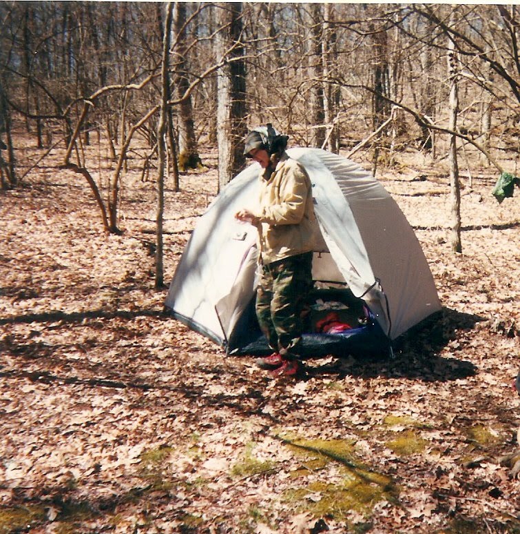
DEEP GAP. The first night taught us a lot about backpacking. Mindy carried our tent and I had the poles and stakes. We put up the tent and awkwardly organized our gear, deciding what belonged in our tent and what we should leave outside, covered over with a plastic garbage bag. Even supper took extra time. We had packed food in so many backpacks, we forgot who was carrying what. Oh well, we finally had a wonderful warm meal of chili, with chocolate pudding for dessert. At that point anything was welcomed. It had been a long day; it was getting colder and I was very tired. It was dark by the time we had cleaned up our dishes. We huddled around the fire to enjoy it’s warmth and the company then slowly made our way to the tents. By 9:30 everyone was settled down. In the quiet of the tent, I suddenly heard the long, low who-o-o-ing of an owl, followed by a similar answer from the opposite direction. Several times there was the haunting call, and each time an echo came, the sounds lulling me to sleep. However, the pure enjoyment of this moment was shattered by the soft, familiar sound of rain falling lightly on our tent. Later the wind began to blow, and several times during the night I wondered if our tents would still be standing in the morning.
DAY 2 – GOOD FRIDAY arrived drizzling and cold. My body did not want to move out of that warm sleeping bag. The rain was making a pinging sound as it touched our tent. Once outside, I realized what I thought was rain was actually SNOW! I couldn’t believe it…SNOW…Marcia had started heating water, and my thoughts were on nothing but something warm to drink.
The snow continued to blow around us and we were all concerned about continuing on to higher elevations. I was not prepared for anything below 32 degrees F. Actually, I don’t believe any of us were prepared for this. I didn’t have gloves; Marty didn’t even bring long pants for this spring fling. We discussed retracing our steps back to the beginning or continuing on. We received a weather forecast from someone on the trail with a radio. It was to clear up in the afternoon and the weekend was to be warm and sunny. With that bit of information, we decided to trust God and Mother Nature, and trudge ahead up the mountain.
The snow continued to blow around us and we were all concerned about continuing on to higher elevations. I was not prepared for anything below 32 degrees F. Actually, I don’t believe any of us were prepared for this. I didn’t have gloves; Marty didn’t even bring long pants for this spring fling. We discussed retracing our steps back to the beginning or continuing on. We received a weather forecast from someone on the trail with a radio. It was to clear up in the afternoon and the weekend was to be warm and sunny. With that bit of information, we decided to trust God and Mother Nature, and trudge ahead up the mountain.
It took a bit longer to break camp. All the tents were saturated with moisture and hard to handle, not to mention, our hands were freezing from working in the cold. Some of us resorted to wearing yesterday’s socks on our hands. Daisy was shivering and we put a piece of polar fleece on her back under her pack to keep her heat in.

Despite it all, optimism was still running high as we started our first leg of the AT. The trail itself wound around the mountain in a gentle slope; it was easy to walk and very beautiful. Snow covered everything in a light dusting. We found that as long as we kept moving we were warm, but when we stopped for breaks the cold penetrated our bodies and my hands were very cold. We hiked the first mile and arrived at Standing Indian Shelter, a three sided lean-to, with a bench and a raised area inside for sleeping. There we stopped to have something warm to drink. Daisy was still shivering hard, so we wrapped her in an emergency blanket and heated her bouillon to drink. Several of us ate our breakfast at this time as well. Instant oatmeal was packed in plastic ziplocks and we discovered we could pour the hot water directly into the bag, kneed the bag to mix, and eat out of it.

A cloud bank covered the mountain, hindering our panoramic view of the area. After our midmorning break we started back on the trail. It didn’t take long to get warmed up again once we began walking, except for my hands. I needed to carry a walking stick, so only one hand could be in my pocket. One in which I carried a disposable hand warmer my son had given to me. I traded the walking stick back and forth, from left to right hands, warming one in my pocket and the other wrapped in a kerchief and a plastic baggie as it held the stick. I must have looked pretty funny, with my makeshift glove, bundled up with two jackets, hat and scarf, then the backpack, and then a bright orange poncho over everything to break the cold wind and keep things all as dry as I could.

The higher we went, the more beautiful the landscape became. We began to see rime ice (also called hoarfrost) formed on the trees from atmospheric moisture. Higher up, because of rain, there was ice a half inch thick on the branches of the trees. We saw two inch icicles, lining the branches, spaced about a quarter inch apart. They formed horizontal instead of vertical because of the blowing wind. And the ice crystals on the tree trunks spread out like feathered lace against the black bark giving a fantasy, fairytale beauty to our surroundings. Our walk soon entered a canopy of rhododendron, each leaf covered in an icy mix. It was like going into a tunnel and entering a winter wonderland.

THE SUMMIT We gathered for picture taking and congratulated each other on making it to the top. The snow was about an inch deep, temperature COLD!! It was time for lunch, however, hoping it would be warmer, we continued on to a lower elevation. We prayed for the fog to break and for the sun to shine.

Going down was just as easy as climbing up. The trail was gentle and sloping with only a few tricky spots. At two in the afternoon we found a nice clearing in a tumble of large flat rocks and we stopped for lunch. We had summer sausage and cheese and a variety of breads. Everyone wanted to lighten their packs, so each suggested using whatever THEY were carrying, particularly the bread. Our great debate was: Which is heavier? A bagel or a pita? Twelve bagels or twelve pitas?

Marcia cut her finger slicing the meat. After returning home her doctor asked why she had not gotten stitches! Oh well, we did have ice handy! Sara bandaged it up and we had our lunch. The sun was trying to peek through, but it didn’t. The snow had stopped falling and it seemed a bit warmer, however, because we were resting, our bodies began getting cold again. So we cleaned up, slid on our packs and proceeded down the trail. As we walked along in places near the creeks, we were sloshing in mud. Pretty ferns and little yellow flowers sprouted along the path. By five, we reached our campsite for that night.

BEECH GAP Upon arrival, tents were set up immediately. The sun was lowering and it was turning bitter cold as we fetched water from the nearby stream. Mindy chose to use tablets instead of pumping it thru our purification system. The main reason for this was that it was just too darn cold to be messing with anything wet.
This evening we made chicken curry and gingersnap/cream cheese sandwiches. The only problem we had, was by the time the meal was ready to eat, we were all too cold to enjoy it. After wolfing down the meal, we packed up the leftovers, cleaned the dishes and headed off to our tents. By this point most of us were shivering and needed to get out of the cold. It was only 6:30 PM, and the dreary thought was… this meant we had a very long and cold night ahead of us.
This evening we made chicken curry and gingersnap/cream cheese sandwiches. The only problem we had, was by the time the meal was ready to eat, we were all too cold to enjoy it. After wolfing down the meal, we packed up the leftovers, cleaned the dishes and headed off to our tents. By this point most of us were shivering and needed to get out of the cold. It was only 6:30 PM, and the dreary thought was… this meant we had a very long and cold night ahead of us.

I went into the woods to relieve myself one final time before entering the tent for the night. Walking west of the tent over a little ridge, I kept our tent in view the whole time. When I was ready to return, our tent had vanished. I started retracing my steps as best I could, but you know, every tree looked the same and camp was still not in sight. I stopped to revaluate the situation, thinking: “Well, here I am in the middle of a national forest with only a small flashlight, a hand trowel, toilet paper and the clothes on my back…and the temperature dropping.” So I listened. Nothing, it was so cold, the birds were even in bed. Truly no night fit for man or beast. I retraced my steps again, and heard the sound of rippling water. “Bingo” I was getting close. We had camped next to a stream. Out of the fog the tent magically appeared, and as I got closer, I thought, “only I could lose camp while going to the bathroom.”
One good aspect was that it felt really good to slide into my sleeping bag after my little jaunt. As I remembered my prayers, I thought about the events of the day. If I had been at home, I would have gone to church for it was Good Friday. Today, I viewed nature’s awesome beauty, but endured the uncomfortable cold and knew there was more to come.
Our second night on the trail was the longest, coldest night I have ever spent in my entire life. At midnight I awoke, wishing it was morning. I guess I woke up at least every hour, all night long. Every item of clothing I had was on my body or flung over the sleeping bag. I even covered my face and still could not get warm. I envied Marcia. She told us the next day that she put Daisy in the sleeping bag with her. I did not crawl out of the tent until the sun was out and beginning to warm the tent up.

DAY 3 SATURDAY As we gathered for a hot cup of cider, coffee, tea or PowerAde (which by the way is very good hot) we began to revise our plans. The cold had taken a lot out of us. If we continued on according to the original schedule, we would be hiking seven miles toward the next mountain. All of us agreed that we simply didn’t have that kind of energy in us. We chose an alternate route, heading back to Standing Indian Campground near our pickup point, via the Beach Gap Trail. It would not be necessary to leave until after lunch. This meant we could relax and enjoy the morning. This was the first time some of us had actually wanted to brush our teeth or wash our faces. I even felt like writing in the journal I had brought along. Several of us hung clothes out to dry on the trees. Mainly, we just relaxed in the sunshine.

At lunchtime, we had a fine meal of bagels, peanut butter, cheese, summer sausage and leftovers we couldn’t enjoy the night before. We chatted and ate and enjoyed the fellowship. After our lunch was put away, we hoisted our packs and headed on down the Beech Gap Trail toward the next camp.

It seemed like we had been defeated by not completing more of the AT, as we had walked just a mere 5.3 miles on the actual AT, but then I remembered that they were the most beautiful and breathtaking miles I have ever walked and realized that it didn’t matter, just being there on the trail proved we had been successful.
The Beach Gap Trail was gentle at first, but not as clean and well maintained as the AT. Walking became difficult in several places. There were several steep paths we had to hike through. In one area all the underbrush had been burned off, and still had the strong smell of smoke. Amazingly, weather now was warm and several of our party were in tank tops and shorts.
The day went quickly. This day, like the first, required crossing several streams and creeks. Daisy loved these, as she got a fresh drink every time. Cody lagged behind at the bad areas and helped the laggers across. Mindy kept looking for morel mushrooms, but I think it was still too cold for them. We did see tiny wild flowers, purple, pink, white and yellow, also ferns and May flowers. Our campsite was at the base of Albert Mountain, the highest point south of the Smokies in North Carolina. We were next to Bearpen Creek which runs into the Nantahala River.

By now we had the hang of setting up camp. Everything was running pretty smooth, even pumping the water thru the purification system. Cody had that down to a science and was so good at fetching water and filling everyone’s jugs. At night we built a campfire and feasted on tomato toss with pepperoni (everyone’s favorite dish) and then rice pudding for dessert. After the dishes were cleaned, we sat around the fire and talked as we watched a full moon rise through a gap between two mountains. It was incredible! Sipping hot chocolate spiced with cherry brandy, we lingered at the fire until 10pm before turning in. It was just too beautiful to go to sleep and I knew the night would be much shorter than the last.
DAY 4 EASTER SUNDAY We woke early for a sunrise service on Easter morn. The pre-dawn was crisp and chilly, with a light covering of frost over our equipment and the ground. As we huddled around the fire, I led the service.

I gave each a small plastic Easter egg, and inside was a tiny feather butterfly. We sang “Jesus Christ is Risen Today” and “This is my Father’s World”. The Scripture reading came from John 20: 1-18. I told the true story of Faberge’s exquisite eggs. We closed with a prayer and the singing of “How Great Thou Art.” It was a very meaningful time, and as the sun rose, the Spirit of Easter was truly with each one of us. All the preparation time, and the cold, hard times were worth it, to share in this unique experience with my Christian sisters.
We had a leisurely breakfast, finding lots to chat about as we enjoyed our most unusual Easter. I broke away from the group and went down to Bearpen Creek, the water supply for this particular campsite. My husband, Earl, had died about six months earlier, and there at a beautiful bend in the stream, with fresh water rippling over rocks and cascading along under green boughs, I brought out of my pocket the tiny container of Earl’s ashes that I had brought along for this very moment. I felt Earl’s spirit very near to me as I cast the fine gray powdered ashes out into the water. There were tears in my eye and a genuine joy in being filled with memories of the good times Earl and I had spent together in God’s beautiful world of nature. I talked with Earl, I talked with God. I ran my fingers through the bright green moss at the river’s edge, and listened as a small wren warbled a happy tune.

Oh, how I missed Earl, but I knew that he was in a better place and I was going to be OK without him. Things were not normal again, but I was finding what a friend of mine called, “a new normal” and it was good. The sun was warm on my back and a light breeze played through my hair as I walked back to camp.

We stayed at the site until after lunch and then headed down the road a mile to our pickup point at Hurricane creek. Melissa arrived in at van and carried some hikers to Marty’s car. Marty, Sara, Cody and I, perhaps, still not wanting the hike to end, chose to walk the last mile to Marty’s car. Our trip was almost over. I truly hated leaving the mountains to come back to civilization. But, since we had to come back, my thoughts turned to my soft bed and the longing for a hot shower as well. I also breathed a sigh of relief that I would not have to dig a latrine this night.
In total, we hiked 20 miles in four days. Not bad for a bunch of beginners and a basset hound. We learned a lot about hiking, nature and each other. I said that if I had the chance, I would go again in a heartbeat. We shared a meal at "Cracker Barrel" and vowed to meet again for a fall hike.


